My John O’Groats to Land’s End Journal
When I initially thought about cycling End to End, I instinctively thought of going from John O’Groats to Land’s End. Being from Exeter, the city where I currently reside, it just made sense. There were two reasons for this. Firstly I didn’t fancy the monumental train journey home afterwards, I would rather get this out the way at the beginning. Secondly, the aspect of riding down through the country would seem like getting closer to home with each mile covered; a big phycological boost.
My route would follow the Official Land’s End to John O’Groats Sustrans Guide. I wanted to take a more scenic route, to take my time and make the most of the experience. My planning consisted of breaking the trip down into 18 days, calculating the distances for each day. Due to my limited budget I also decided that I would wild camp various nights with also a few nights of luxury staying in hotels or B&Bs. My trip would be completely self-sufficient and I would be on my own.
Day 00
London Euston to John O’Groats
The day had finally arrived! After all the months of planning, dreaming and buying gear for completing John O’Groats to Land’s End, the time was here. Although, it has to be said, getting to the start was the part I was definitely not looking forward to the most.
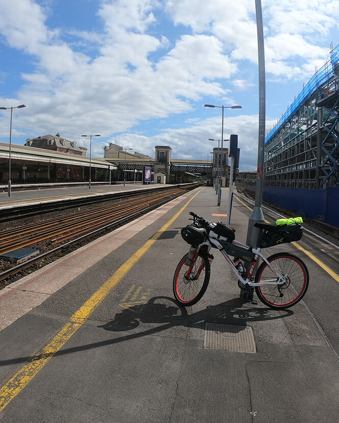
The morning started off fairly relaxed, popping into town to pick up some final bits, making last minute preparations to my kit. With everything prepped around mid-afternoon, I set off to catch the 15:39 train from Exeter St David’s to London Paddington.
A minor oversight I thought, riding down to the station, this was the actual first time I had ridden my bike, fully laden. This was perhaps a bit of a schoolboy error; I should have taken it for a long test run before hand to see if there would be any issues with straps and cables.
Waiting on the platform, in zone 2, as that was where the bicycle carriage was due to stop, a feeling of apprehension came over me. Did I fully know what I was letting myself in for? I had watched countless touring videos, read numerous blogs and if the worse came to the worse I could purchase whatever I needed on route. I had never undertook anything like this before. Would I be able to complete it? I immediately dismissed the negative thoughts. Of course I would!
The train pulled up, the doors opened and low and behold, no cycle spaces, it was the wrong carriage. Why was I not surprised? The screen had lied to me and there were no signs on the outside indicating where the cycle spaces were.
I frantically started to jog back down the train peering in door after door, conscious that any second the whistle would blow, and doors would start to close. Not many people got on since it was mid-afternoon on a Wednesday. With relief, I finally spotted the cycle hangers. Leaping onto the train I hauled my bike on with all of my strength, with some difficulty, as it weighed a ton, managing to heave the front wheel up to secure it in the hook and settled in for the 2.5 hour journey to London.
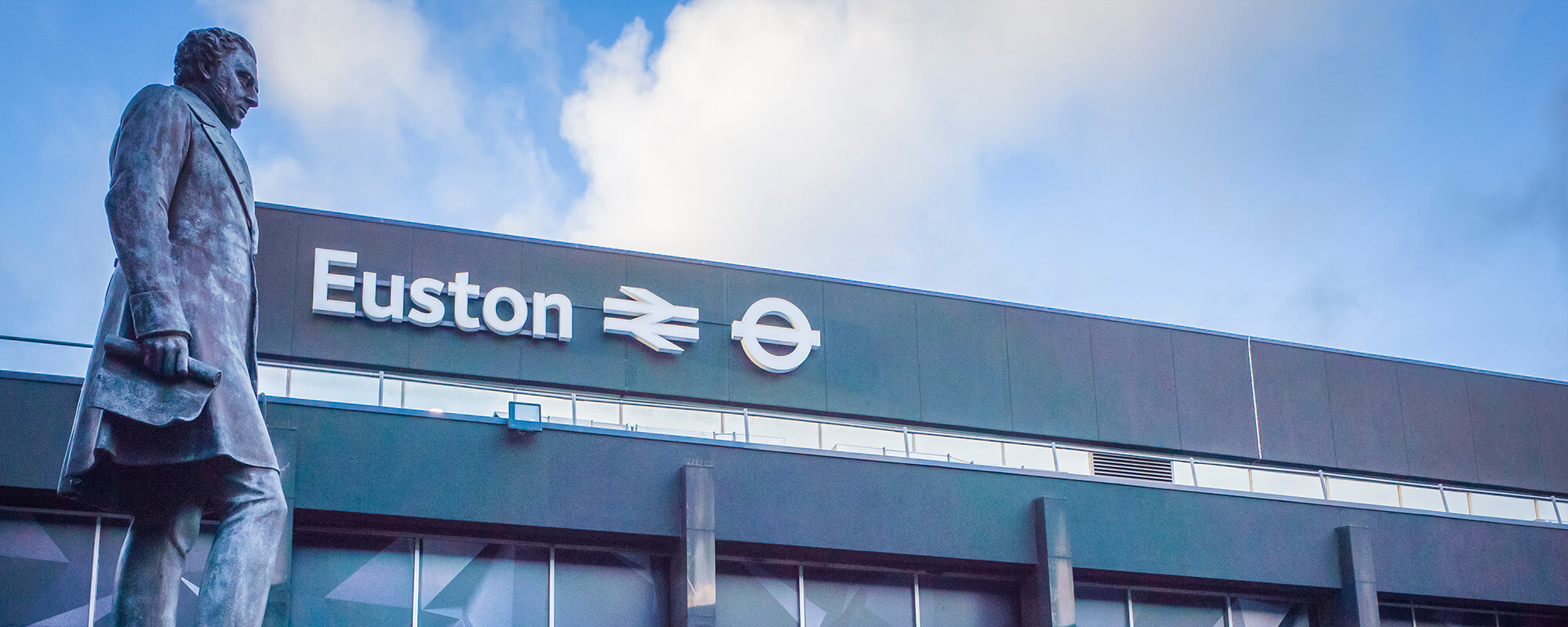
Upon arriving at London Paddington, it was a 2-mile ride across London to Euston. I must admit that riding through a major city is a new experience for me, one that I wasn’t sure what to expect. I discovered that it wasn’t actually that bad. Probably, because I had missed the rush hour chaos. One thing that immediately stood out was the amount people whizzing about on Brompton’s.
After safely making it to Euston I had about 2.5 hours to kill. I decided to take a walk around to the front of the station and get some pictures for the blog, but the whole place was covered with scaffolding and building works.
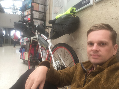
As I was stood looking at google maps, seeing what was around, I was greeted by a fellow, that I would politely describe as a reprobate. He complimented me on my bicycle and asked if he could have a go; I declined by telling him I had a train to catch, quickly making my way inside the station, before I was potentially robbed of it. It was the busiest station I have seen, making my way over to a vacant wall I propped myself up against it and spent the remaining two hours people watching.
Finally, the announcement came over the speaker “the Caledonian sleeper to inverness is ready to board on platform 1”. Thank God! I made my way over to the waiting train, quickly loaded my bike and found my seat in the carriage. I wanted to keep the price as low as possible so had chosen the cheap seats at £50. The whole train fair, Exeter to Wick, costing about £80. I had originally booked a place on the new fleet which was supposed to be entering service. However, with a delay in rolling out the brand-new carriages, this meant travelling on the extremely dated train.
On finding my seat, to my horror, there were no power sockets to charge anything. I couldn’t use my phone for entertainment, so naturally had to turn it off for the entire journey to conserve the battery. This meant getting lost in my thoughts, as well as a little sleep, for the entire 12-hour journey. Something that would no doubt drive most people insane!
However, the wide, laid back chairs I found to be quite comfy and here I settled; pleased that everything had gone so smoothly, bound for Scotland. I even managed to get about 3 hours sleep in the end.
Arriving at Inverness station, I spotted two other cyclists with fully loaded bikes. They probably had double the amount of gear I had. Each had four panniers, two front and back, along with a massive dry bag strapped across the back two. I did wonder if they had completed LEJOG and how on earth it would be possible to ride with all that gear.
It was yet another couple of hours wait for the final train to Wick. I again, found a wall to prop myself up against, this time sitting, reminiscing on the other times that I had visited Inverness. Also thinking that I would be passing back through in a few days.
The display board flicked to show the platform of the waiting train, I once again excitedly, scurried over to the platform, to the waiting train. My bicycle reservation was checked off and I boarded; this journey taking 4.5 hours. This part was probably the worst out of the lot because it seemed to take an eternity; I was anxious to get underway. However, I was intrigued, I had never been further north than Inverness before, the scenery was certainly beautiful.
A word of advice, if you plan on taking your bike on the train which runs between Wick and Inverness, ensure that you have booked a bicycle reservation. There are only four spaces with demand being high during the spring/summer months, mostly from people returning from LEJOG.
Day 01
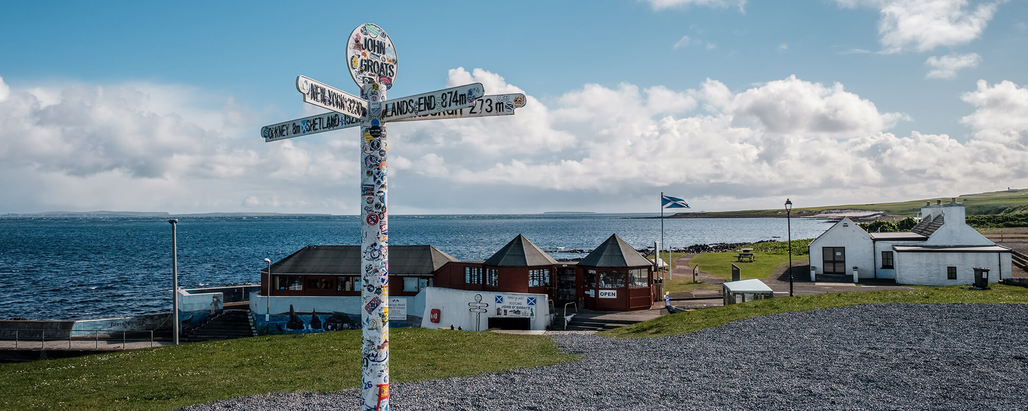
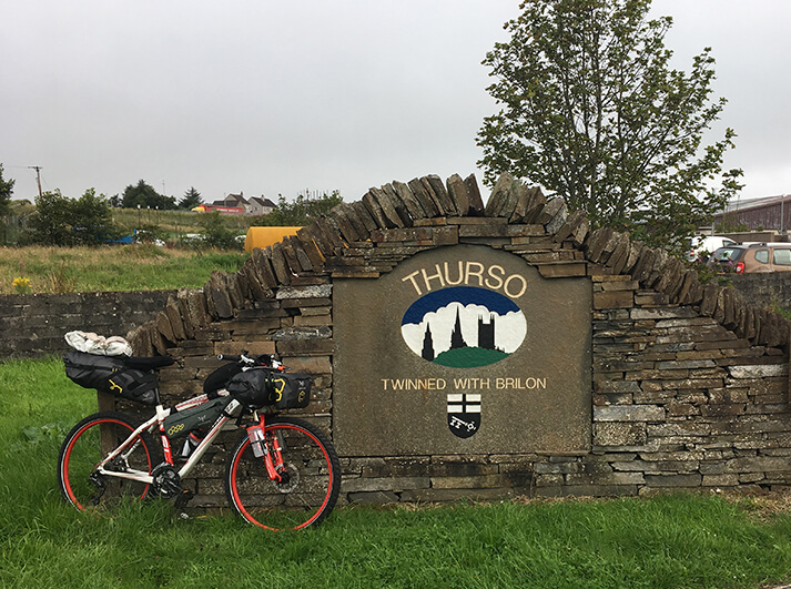
John O’Groats to Thurso – 21.39 mi
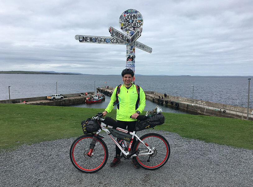
I arrived at Wick just after 3:00pm as there was a slight delay in the journey time. The exhausting experience, of what was a monumental journey, vanished from thought. John O’Groats, the starting point, seemed like it was just around the corner. Even though I still had 16 miles to cover to reach the famous signpost and begin my journey. Again, I made final preparations to my bike, securing lights, tightening straps, changing into my riding gear, set directions on Google Maps and went on my way.
Heading left out of the station, over the bridge, was an easy route to follow, simply stay on the A99 all the way to John O’Groats. I was expecting the worse with regards to the weather conditions, I can imagine the northern most point must get battered by the strong prevailing winds. But, to my surprise it wasn’t bad, there was a dull grey tone to the bleak landscape; the sky overcast with glimpses of blue sky in the distance.
The route seemed fairly flat, until reaching Freswick. Here, a long gradual incline lead up and passed through a large expanse of moorland either side of the A99, before the final descent into John O’Groats, the northern most point of mainland Britain.
After rounding the final corner, I felt so much exhilaration, it was a long straight that lead down to the iconic area, which I could see in the distance. I had a huge smile on my face. I was absolutely elated to reach the most northern point, an area I had never seen before.
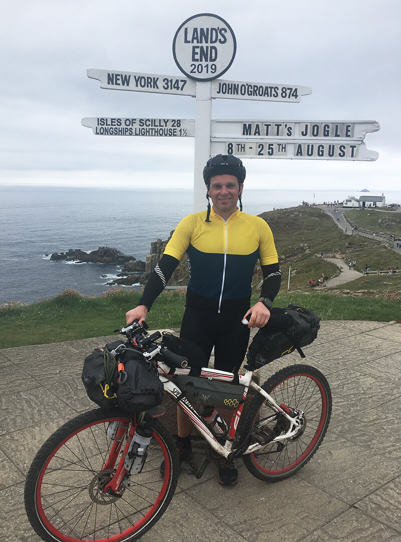
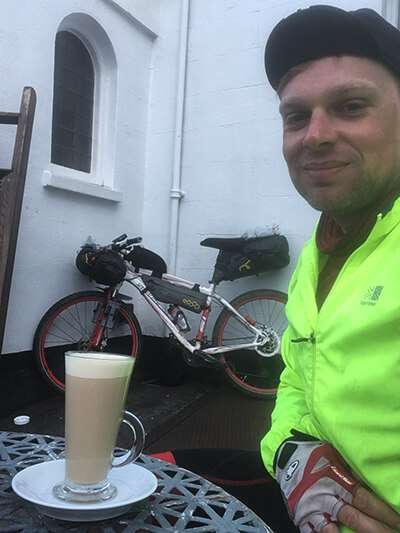
Looking at my watch it had taken near enough 24 hours from stepping out my front door back in Exeter. As I pulled up close to the shops, I quickly looked around for the signpost so I could get my picture taken; I spotted it and headed straight over. A couple who just completed LEJOG were in the middle of taking pictures, both congratulating me on arrival thinking I had just finished, to my grimacing and stating I was only just about to set off.
Another guy who had also just reached the end, who I believe was called Steve, completed it in nine days! He took my picture, we got chatting and went into the café where he very kindly bought me a coffee and continued talking about his experience, I was very interested to find out more about his trip. He cycled it in 9 days! I was in complete astonishment.
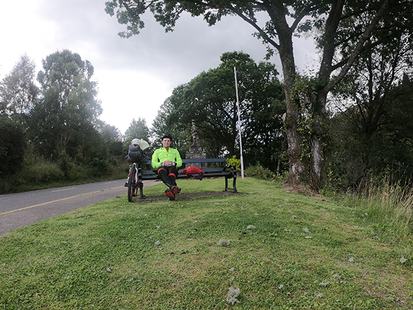
With the final sip of my coffee, I decided I couldn’t hang around too long as time was getting on, I had another 15 miles to cover before reaching my first night’s stop at Thurso Bay Caravan & Camping Park, a camp site in Thurso. I thanked Steve for the coffee, congratulated him once again.
I had a quick look around the area, taking a few pictures, buying a customary magnet and post cards to send home to family members. I was even greeted by a Danish naval officer who come up and enquired what I was doing, we chatted for a bit. But the time had finally come to set off for home.
A tightening of straps and I set off up the road from which I whizzed down with much excitement, making a right turn at the sign directing me to Thurso, some 15 miles away.
As I was following the Sustrans Cycle Network, it was mainly quiet roads that I would be following so rather than continue along the A836 all the way to Thurso I took the more quiet road that followed alongside all the way to Castletown, stopping to admire the long sweeping beach and remarked what a lovely place to wild camp.
After passing through the village and stopping off at the local shop for some water, I again kept to the back road, National Cycle Route 1, which eventually joined up with the final section of the A9 leading into Thurso. In all, my experience so far had been rather pleasant, despite the lack of sleep, the weather was at least good.
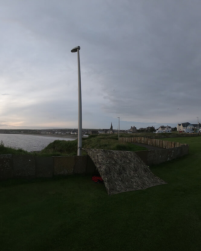
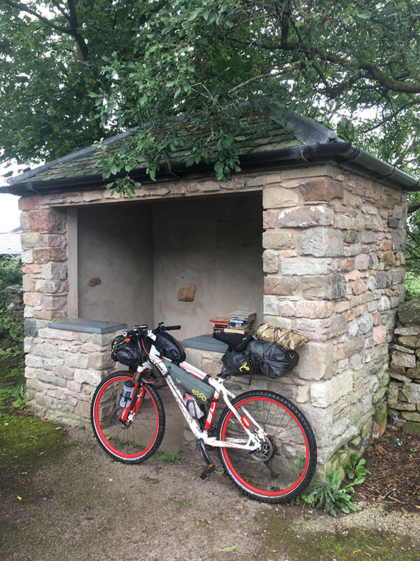
I arrived at Thurso Bay Caravan & Camping Park sometime just after 7:00 pm. Using a tarp to camp does present a problem, you usually need to tie at least two ends to something, to create some sort of lean-to shelter. Looking around all I could find was the lamp post that stood on a public path which went around the perimeter of the campsite. I propped my bike up against the fence and bungeed one end of the tarp to the lamp post, draped it over my bike so it was fully covered and pegged the other corners into the ground; it was enough to keep me dry at least. It didn’t even occur to me at the time, the light from the lamp post would be shining right above me for the entire night!
Once I had set up camp I sat against the fence, sheltered from the wind, cooked up some rice and tuna for dinner, pleased in the knowledge that I was finally underway, heading back in the direction of home. Soon after I crawled into my sleeping bag, even though most of the night was spent tossing and turning, I did finally manage get a few hours sleep.
Day 02
Thurso to The Crask Inn – 67.34 mi
I woke up early, from the little sleep that I had managed to get, and decided I should set off early whilst the roads would be quiet. After a quick wash, I packed up all my gear which seemed to take more time that it should have from faffing about, secured my bags and headed out of the campsite continuing on route 1, along the B874. It was surprisingly busy considering the number of trucks that came hurtling past. The road eventually joined back up with the A836 and I stayed on here, roughly 20 miles to Bettyhill. It’s pretty quiet for an A road with long gradual inclines which made for equally long descents.
Passing through the village of Bettyhill I immediately spotted the general store. I thought this would be a good place to stop off and fuel up. I dashed in to pick up some Scotch pies, chocolate bars and a couple cans of pop, headed round the corner and parked up at a picknick table beside the local park, managing to scoff the lot down within minutes, just as it started spitting rain. Little did I know that these first signs of light rain would be the start of near enough 7 days of downpours, getting completely saturated each day.
Leaving Bettyhill, it was another 12 miles to Tongue, not that I remember much of it as it was a case of head down and just get on with it. I had donned my waterproofs, which didn’t stand a chance, I only had a pair of sunglasses to prevent my face getting covered in spray, so could hardly see a thing from the brown tint, but they did keep the water out of my eyes.
After seeing the entrance for Weavers Craft Shop & Café, I didn’t need to think twice, I was straight in there. Completely wet through I took great delight in ordering a toastie, cake and coffee savouring the warmth and being out of the rain.
It was no use in putting it off any longer, I needed to press on. I put on my wet jacket, stepped out into the pouring rain and continued on my way. After rounding the corner from leaving the café, I branched left, continuing on the A836. It was about this point that I had a big phycological boost, I was no longer heading along the top of Scotland, I had actually started to head down the country, which meant every pedal and every mile was getting me closer to home and the finish line.
I was now on an incline leading up above the village of Tongue. I did stop to take in the sweeping panoramic view of the Kyle of Tongue. Castle Bharrich could be seen perched high on the rugged hill side over to the left, with the causeway to the right. Although the view was hampered by the mist and rain, on a clear day it would be spectacular!
After reaching the top it was about a 2 mile decent to the edge of Loch Loyal. With the rain still pouring I continued along close to the edge of the loch, having to pull into the passing places every so often to let cars pass me. The distance from the both ends of Loch Loyal were only just over 4 miles, it certainly seemed longer than that.
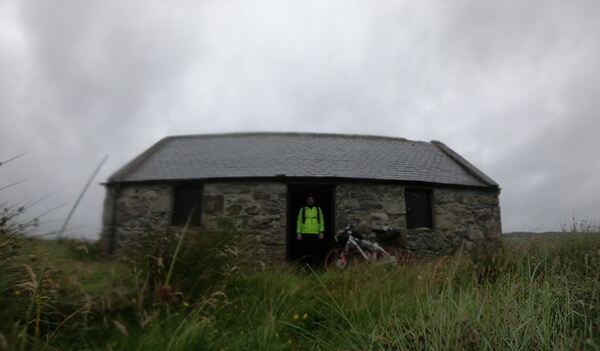
At the bottom left corner of Loch Loyal the road continued for a short distance before turning left and heading over the river that joins Loch Coulside. And where on the other side of the bank I discovered a Scottish Bothy so decided to take a few minutes recess, a welcome break from the weather.
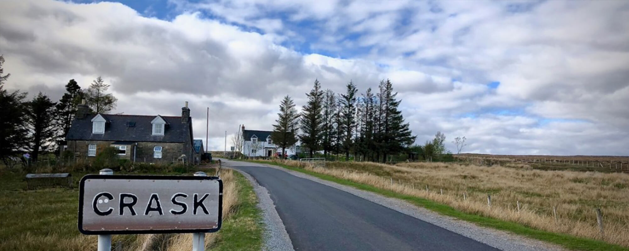
Leaving the bothy was another long steady incline. Coming over the brow of the hill and starting the descent I could see buildings in the far distance and a thought popped into my head, was it the Crask Inn? I instantly shooed the thoughts away as to not want to get my hopes up, I thought I’d give the map a check anyway so stopped and discovered it was Altnaharra; it was another 7 miles to The Crask Inn. When I eventually did see Crask though I gave a jubilant shout, my morale had returned. A warm bed for the night, a three-course meal and a chance to sit down and relax with a pint, not forgetting being able to get out of the rain and dry off.
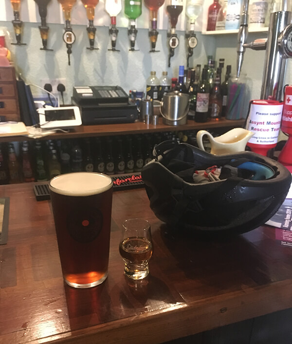
Entering Britain’s remotest pub, I was confronted with a rabble of cyclist, there must have been around 16 people. My first thoughts were, where did everyone come from? It turned out that a supported group of riders had just finished their second to last leg at the Crask Inn. They were due to return the next day and finish their final leg of LEJOG. Thankfully they weren’t staying long and a bus was coming to pick them up soon.
I ordered myself a well-deserved pint and dram of whiskey from the Crask’s vast selection and chatted to a few of the friendly cyclist, who sounded shocked that I was riding north to south, part wild camping on route. One of the group was named Claire, Claire if you’re reading this thank you for taking the time to email asking how I was getting on, it was certainly a hugely needed morale boost, which I shall touch upon on my arrival to Bridgnorth on Day 12.
After the group had left, I stored my bike away and was shown to my room. I finally managed to get out of my wet gear, hanging it above the roaring open fire in the bar and thought I’d make the most of the drinks on offer, so had another pint. In total there were seven of us staying for the night; two other cyclists, a Scottish couple who had decided on escaping the Edinburgh Fringe festival and a German couple over on holiday.
At dinner the staff encourage all guest sit around the same table and socialise with each other, what a great idea. The homecooked food was wonderful, a starter, fish pie for the main and dessert to finish, which was soon devoured; it was then a return to the bar for another pint. I can certainly recommend, if you ever decide to do LEJOG/JOGLE, you need to plan in a night at The Crask Inn. It’s a unique little place and the staff were extremely helpful and friendly.
Day 03
The Crask Inn to Inverness – 72.16 mi
No sooner had I closed my eyes, I was awake again, although, I did have the best night’s sleep since I had left Exeter! I went down for breakfast at 7:30 and fuelled up on as much food as possible, a bowl of porridge, which happened to be one of the nicest bowls of porridge I’ve had! As well as a fry up, toast and about 3 cups of coffee to set me up for the ride down to Inverness.
As soon as I stepped outside the midges attacked! When planning my trip, I wasn’t sure what to expect and how bad they would be. Fortunately, this was my only experience with them, which was thankfully short lived. A squirt of repellent on my hands and face did the job.
Just as I was strapping on my bags and carrying out final checks the large cycling group from the evening before had returned to finish their final leg to John O’Groats. After a hello and wishing them well I then continued on my way down the A836, heading to Lairg. This stretch was, for the most part, all downhill making it a nice easy start to the day; it seemed like I covered the 12 miles surprisingly quick.
Reaching Lairg I pulled into the large carpark overlooking Little Loch Shin, a manmade loch, created by the hydroelectric dam scheme. Here I grabbed a quick recess, pleased with myself at what seemed like getting there fairly quickly and opened a celebratory bag of Haribo.
Leaving the car park, it was then over the bridge onto the A839, and along the B864. The road winding along the valley side, running parallel alongside the River Shin. Most of this section was encapsulated by woodland either side, with glimpses of the river flowing fast below. Heading along this road, out of nowhere, a hidden gem appeared, the Falls of Shin Visitor Attraction leapt out at me. Especially the café! I went in for a closer inspection but decided against stopping. It felt like I was still early into the ride and I wanted to make up the distance. I later learned; it is apparently famous for being one of the best places in Scotland to watch salmon leaping upstream.
After my quick recce of the café I continued on my way. Passing back over to the opposite side of the river and joining back onto the A386, following the road into Bonar Bridge. A couple quick photos and a check of the map, it was then over the bridge and around into Ardgay, on spotting Ardgay Shop And Highland Café, this time I felt obliged to sample a coffee and cake, a treat for doing so well I thought. It was also a good time to stock up on supplies of Haribo and a couple cans of pop for later on.
After a 30-minute rest, it was time to press on, continuing along the National Cycle Route 1, up unto the turning left on the B9176. I knew what was coming, I had already prepped myself mentally. As soon as I turned right onto the B9176, it was straight into, what would be a 2-mile climb. I quickly found the easiest gear and settled into the climb at a snail’s pace, no doubt walking would have been quicker. It would be much like climbing up and over a mountain, or at least in between two, Struie and Cnoc an Liath-bhaid.
The weather had held out for most of the day, just as I had past Struie Hill Viewpoint was when a light rain started to descend. It wasn’t a lot but nevertheless I decided to pull over and put on my waterproofs, which always seemed like a time-consuming process. More so when it came to taking them off.
From my past experience, I would get wet either way. The waterproofs would eventually become too saturated and the water would just seep through or due to my jacket not being that breathable, I would sweat underneath and get damp. I guess, I felt if I had them on it wouldn’t be as bad. But, and just as I thought, a few minutes after the light rain appeared, it decided to stop. So, it was off with the waterproofs!
After following the B9176 around the western side of Cnoc Corr Guinie, the road lead into a much-needed long descent, this lead all the way down, joining up near to the A9. It was then along the B817 passing through Evanton and along to the town of Dingwall, where the rain had returned with a vengeance. It began to pour down.
This time there was no messing about, the waterproofs were on in seconds, and I was absolutely soaked. Knowing that I was supposed to be wild camping tonight filled me with a slight dread. The thought carrying out wet and dry drills, changing into dry clothes during the night and putting wet gear back on in the morning did not spark any enthusiasm in me!
At Dingwall, the route headed left along a cycle path following alongside the A835. After crossing the River Conon, it was then a combination of back roads and cycle path that followed parallel to the A835 and A9, leading down to Kessock Bridge. I did chuckle to myself when passing a large road sign displaying a warning for severe weather for the weekend. Fortunately, the closer I got to Inverness the worst of the rain had dissipated and remained dry for the remainder of the afternoon and evening.
Once over the other side I made my way to the River Ness, heading through Inverness city centre, only managing to take the wrong direction twice. But nevertheless, I navigated my way through pretty quickly. Following the book, the route then lead out towards Culloden, situated nearby is Culloden Battlefield, which unfortunately I didn’t get to see. After arriving at Balloch, I turned right onto Culloden Road, into a long climb. It had got to the point where I had completely exhausted all of my energy levels. Apart from the bags of Haribo and café stop back in Ardgay; the only meal of the day had been the large breakfast at The Crask Inn.
I came to a wooded area up ahead, I noticed a small turning area and grassy roundabout, seemingly used by buses judging by the bus stop. Completely exhausted, I threw myself onto the grassy roundabout, spread eagled, and laid there staring up at the sky. A short time later I looked around and discovered close by a track leading into the woodland. After deciding I was completely done for the day, I went in to the woods to investigate and thought it seemed like a good place to camp for the night. It was around the location that I had planned on getting to, so I was happy with the progress I had made for the day. I quickly set up camp, made dinner, boiled rice and tuna, also scoffing a few other snacks.
Day 04
Inverness to Aviemore – 34.60 mi
After a poor night’s sleep, only getting a few hours of snoozing, as well as needing to make emergency alterations to my basha in the middle of the night, as I was getting soaked, I eventually woke to the patter of rain once again. It was turning into a real miserable experience, here I was camped out in woods on the outskirts of Inverness, still damp from the day before with hardly any sleep and it must have been about 4:30 in the morning.
Whilst still snuggled up in my cocoon like sleeping bag, I checked the weather and it wasn’t looking good; more torrential rain! I decided I didn’t want to face another night in the wild after another day of getting soaked. I did a search for accommodation and luckily to my absolute delight, managed to book myself into one of the last of two beds available at Aviemore hostel.
When you’re wrapped up in a warm, snug, sleeping bag, it takes a tremendous amount of will power to get out in the rain and pack up all your gear. Which I did, after laying there for another three hours before getting going, sometime after 8:00am. I wasn’t too hard o myself as it was going to be a short distance compared to other days and check in wasn’t until 3:00 pm.
No sooner as I had stepped out from the woods, the rain had started its onslaught again. I pulled over to put my damp waterproofs on and continued onwards, head down, thinking to myself I couldn’t have chosen a better week to do this!
The route passed next to Clava Cairns, I wanted to stop and have a proper look. Since the rain was heavily pouring, I peered from my seat at the large, Bronze age, circular tombs and slowly cycled past. Shortly after, making a right turn into an incline. Despite the rain, I was gifted with a beautiful view, in the distance stood the impressive Culloden Viaduct stretching 1800 feet across the landscape. The view certainly took my mind off the climb. Reaching the top, I then join up with the Highland Main Line, running between Inverness and Aviemore, heading along to arrive at the B9154.
After an initial climb out of Craggie, the rain easing off, it felt like a leisurely ride, along to Moy bypassing Loch Moy on my left. The route then followed close to the A9 for another 4 miles passing through Tomatin, where I was unsuccessful at stocking up on sweets at the village shop due to it being closed. I then joined back up to the A9 and continued alongside, although out of site to the A9, over to Carrbridge. I remarked this section was a real joy to cycle on with the far off reaching hills either side of me, panoramic views in the distance and woodland made for a remarkable cycle.
Arriving at Carrabridge the rain had once again returned. I did consider, as my eyes darted at the numerous cafes, to stop but decided against it and sped straight through, until arriving and joining up with the A95. It was then a left turn as I made my way over to the small village, Boat of Garten. This time I did spy a café and as I still had time to kill and I was so close to Aviemore I decided to stop for lunch as well as get out of the pouring rain.
The jacket potato, coffee and cake certainly went down really well. It wasn’t long until I pressed on, along the final 5.6 mile stretch into Aviemore, consisting of winding my way along the National Cycle Route 7, surrounded by heather covered moorland and dense forest. I even got a glimpse of the passing steam train, bellowing its way along the Strathspey Railway to Broomhill.
I got to Aviemore with an hour still to kill before check in. I sat on the bench in the main car park pleased with my progress to date. I managed to sort some admin out, getting rid of rubbish, then pressed on to the hostel. As soon as I got there the bike was placed in the bike store and went to my room with a wonderfully comfy bed. It was then a quick change out of my wet gear which all went into the drying room. I have to say that as far as hostels go, I was seriously impressed with Aviemore Hostel. I definitely recommended staying there, the facilities are superb!
One of the great things about staying in hostels are the people you randomly get to meet. Over the course of the afternoon and evening I got chatting with an Erika from Australia, Linus from Munich who was also sharing a room with me, and Cameron, we all went for a drink at a local pub. It was a pleasure meeting you guys!
Day 05
Aviemore to Pitlochry – 59.47 mi
After an all you could eat breakfast at the hostel (I certainly tried to eat as much as I could), I followed the same routine, loading up my bike ready for the day ahead, plus, giving the chain a good oiling. I managed to catch Erika, Linus and Cameron in the morning, before departing and said goodbye. Setting off, I felt a fantastic, I was well rested, well fed, and there were even glimpses of the sun shining in the sky.
Leaving Aviemore, my route led down to the roundabout. Then a left turn along to Iverdruie, then onto the B970. From here was a stunningly beautiful route to cycle along with woodland either side of the road, occasionally bypassing the odd house.
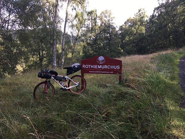
I had travelled this road by car, some years prior. We took a trip to Inshriach Nursey to check out the tearooms. This place was truly a hidden gem in the heart of the Rothiemurchus. The cakes were astoundingly delicious. But the best part was the conservatory that looked out towards a number of bird feeders that had been set up hanging between the trees. I remember the wonderful experience of having never seeing so many birds feeding, hundreds of different birds all hoping about waiting to get stuck into the bird feeders. Even red squirrels got in on the action, they would scurry down the trees load up on nuts and scamper back off. They would then repeat the process. I could have stayed for hours watching this hive of activity. Sadly, before my trip I discovered that the nursery had since closed.
The route continued on through to the small town of Kingussie, along the A86 to Newtonmore, where the trail would join up with the A9. The plan was essentially from here to follow alongside the A9 all around the left-hand side of the Cairngorms, for the most part, all the way to Pitlochry. If you’ve not carried out any research or were wondering which route to take, I would say to avoid this way if possible. Especially if you’re on a road bike as the quality of the A9 cycle path was horrendous. It was broken tarmac in a lot of places.
It wasn’t long until joining the A9 cycle path that had an experience that I would not like to relive. I arrived at a layby where construction workers were carrying out resurfacing to the path. So was told that I couldn’t proceed along the cycle path and would have to go along the A9. It took me a few seconds to register. I looked at the traffic, trucks and cars were hurtling past, in both directions. I thought did I just hear him correctly.
Nevertheless, I waited to cross to the opposite side which seemed to take a while due to the sheer amount of traffic coming towards me. I eventually made it onto the verge well out of the way of traffic. During the crossing my water bottle decided to jump out of the front bottle cage, I turned to see it rolling in the road close to the side a few metres back. Then noticed the huge lorry, in the not to far distance coming in my direction. I thought it best not to go back for it and sacrifice the bottle.
I let the lorry pass and continued on the stony verge at the side, keeping away from the road. This turned out to be too bumpy and impossible. After there was a break in the traffic I got back onto the road and cycled a few hundred metres. After I had passed the construction workers over to the far side, I thought sod this. I crossed back over to continue along the cycle path, well away from the main road. The best thing about taking this route was the decent which started roughly after the large sign displaying ‘Slochd Summit 1315 ft (401 m) above sea level’, it was downhill for a very long way afterwards.
During my planning phase a friend recommended that I visit The House of Braur, after carrying out research I discovered I definitely should! My route passed right past the entrance so ensured I definitely had to factor in a stop!
I arrived at the entrance, locked my bike up, and immediately proceeded to the fish and chip shop as I had been craving fish and chips since setting off. Next it was straight across the road to explore the isles of food delights. As soon as I walked through the door, the biggest grin beamed from my face, my eyes couldn’t keep still, they were constantly darting from one thing to another. I could have spent an absolute fortune in here I thought. Luckily, I was short on space. In the end, I came away with a pack of biscuits, some Scottish tea, a pork pie and a scotch egg.
Setting off, an inconvenient event happened, something that took me by total surprise. As I went to pedal, to my discovery, the chain decided to simply come away. I looked down and could feel a thought of dread slowly building. Here I was, still 10 miles from Pitlochry.
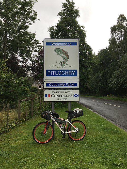
I calmly made my may back to the cycle park, replaced the broken link, that had become completely bent backwards, with a split link. I was back on my way within minutes. Just in time for the rain to return, which turned into a torrential downpour, reaching Pitlochry hostel completely drenched.
After a warm welcome at checking in I placed my bike in storage, my wet kit went in the drying room and headed to the local Co-Op to stock up on supplies. I would have liked to explore more of Pitlochry as it was set in a beautiful location, surrounded by Perthshire’s Highlands. As the hostel was perched high up above the town, the dining room provided great views whilst I was gorging on food, planning my route for the next day.
Day 06
Pitlochry to The Trossachs – 67.41 mi
The hostel provided breakfast so decided to take them up on the offer once again, you could basically eat as much as you like. It was the same as in Aviemore. A bowl of cereals, a selection of ham, bread rolls, Danishes, fruit and copious amounts of coffee. I made sure to eat as much as I could. After a hearty breakfast I saddled up and headed off once again.
I made my way down to the main road that lead through Pitlochry, crossing over the Iron suspension bridge. My route followed along National Cycle route 7, running alongside the River Tummel. To my right Dunfallandy Hill rose high into the sky, with its beautiful wooded hillsides. There was certainly no way of getting over this other than to head around the south eastern tip of the hill, passing to the west of Logierait. From here, the route headed west alongside the River Tay all the way to Kenmore.
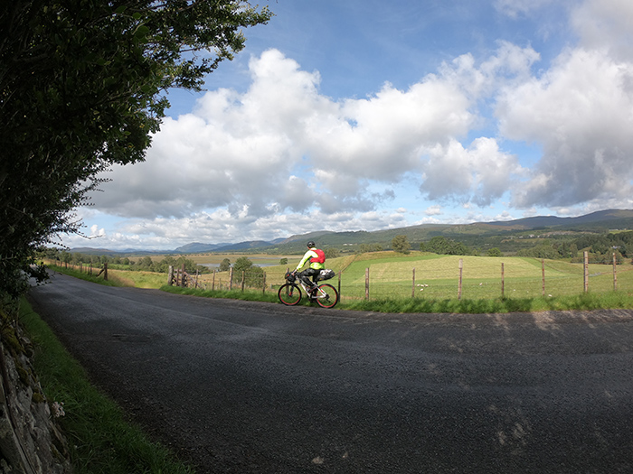
I had planned for Kenmore to be a, well-rewarded, rest stop. The village located at the northern end of the 14-mile loch looked beautifully idyllic. There was even the perfect bench located at the shoreline providing a picturesque view out over the visible area of the loch, with Ben Lawers standing in the distance. However, no sooner as I arrived at the bench, I made a disappointed sigh. I prayed if there would ever be any let up? Rolling down off the side of the mountain was a large formation of rain clouds, heading straight towards me. So much for relaxing by the loch, my waterproofs were on in seconds and I decided it best not to hang around.
The road continued along the southern edge of the loch. Fortunately, I didn’t get too wet. Upon reaching about halfway I decided to have a short break overlooking the loch, so took pleasure on devouring a couple of chocolate bars and a can of fizzy pop. The sun even decided to make an appearance, so I made the most of basking in the sunshine for a few short minutes.
It was a relief to make the western edge of the loch and pass south of the village of Killin. Forteen miles doesn’t sound like much on a bike but the loch seemed never ending. Before my turn off I noticed a bench next to the Killin’s War Memorial, with the River Dochart running close by. It was the memorial that really caught my eye as it was a beautifully carved stone statue of a Scottish soldier, stood on a plinth with the inscription of all the names of those who lost their lives in both world wars. After taking the time to pay my respects I took a seat and devoured my goodies I purchased the day before at The House of Braur, ever conscious of the gloomy overcast clouds above my head.
As always, I didn’t stop too long. I still had a fair distance to cover, with the intention of getting as close to Aberfoyle as possible. From the bench, I headed a few metres back and up a gravel track, doubling up with the Rob Roy Way, a hiking trail. At the tip of Lochan Lairig Cheile, the route merged into another trail, The Glen Ogle Trail, and I was certainly in for a treat. The path followed an old railway line from Lochearnhead, for me going in the opposite direction it was downhill all the way. Being quite high up, as I sped down from the mountain side, the view over to my left was breath-taking, a panoramic view of Loch Earn and Ben Our, a popular Munro.
After the exhilarating descent, it was round to Strathyre, keeping to the cycle trail, weaving through areas of woodland and open land, exposing Loch Voil River as it snaked close by. It was not long after that my bike decided to start making a clicking sound. I pulled up at a bench to checked out the chain. To my horror a link had come away from the pin and was just about holding on. After a few curse words but manage to quickly fix it. I also took the opportunity to do a search for any bike shops on route. I thought it might be a good idea to buy a new chain before any more links decided to give out.
I pressed on, as I made my way around Loch Lubnaig I passed through Forest Holidays Strathyre, a holiday park. The trail ran right through the middle of the park and is where I met a Jacob. He stopped me and enquired on where I was heading. I told him and he very kindly helped me fix the issue with my chain. It turned out that he was the park bicycle mechanic, I couldn’t believe my luck! Struan also appeared and he very kindly rode with me all the way to Callander and even offered sorting me out a room in the local hostel.
As it was, it must have been getting near 6:00 pm and I wanted to get as close to Aberfoyle as possible. I certainly didn’t fancy making up the extra distance in the morning so kindly declined the offer of the hostel, deciding I would ride until last light if need be. From Callander the route led west past the western edge of Loch Venachar. By this point I was now very low on energy. I knew there was a steepish climb so thought I would get over that rather than attempt it in the morning.
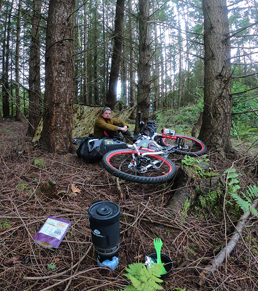
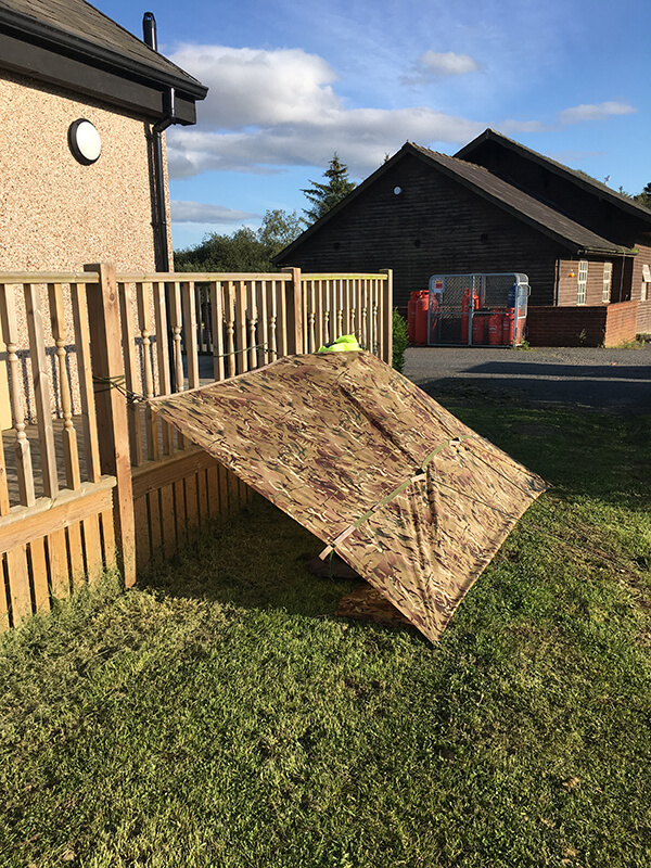
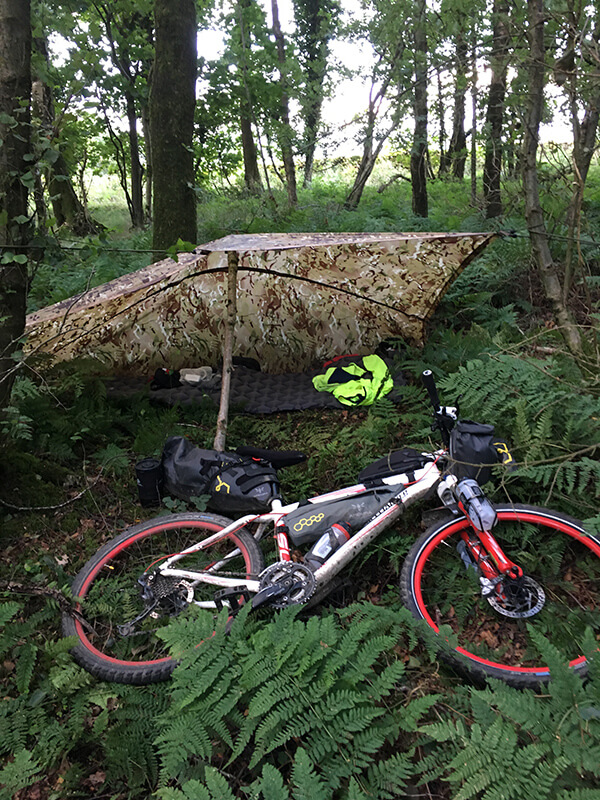
After heading along Forest Drive, a gravel road running through the area. I came to a large parking area, with toilet block. This would be the perfect place to camp, so immediately set about finding a decent patch of woodland to set up camp. After a few minutes of running about the area searching I had managed to find a, relatively flat, area with two trees the perfect distance apart to be able to properly set up my tarp. The spot also providing enough cover from the rain. Once my basha was erected, I sat back please with my efforts for the day.
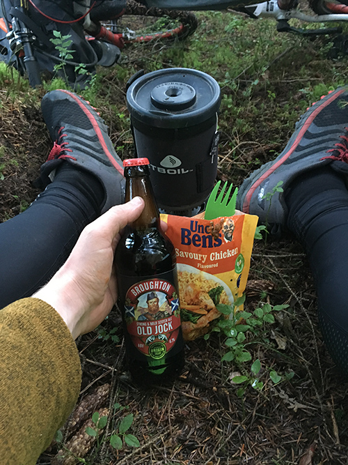
Whilst cooking tea, the standard boiled rice and tuna, I had a friend join me. A little robin came and greeted me, hopping from branch to branch, occasionally landing on the front wheel, literally right in front of me. As I was eating a bag of fruit and nut mix I threw him some which he proceeded to pounce on. He stayed with me for some time, continuing hoping about the place, chirping away, until the darkness came.
Day 07
Trossachs to New Lanark – 84.07 mi
The evening before, I thought I had made it over the highest point but was disappointed to learn that I actually hadn’t. plus, I still had quite a way to venture before reaching Aberfoyle. I skipped breakfast where I camped, deciding to press on early in the morning and pick something up in Aberfoyle. It was really hard going, making it up and over the final hill proved tough, my energy was completely wiped out. However, once over it was a fast descent all the way into the village.
Thankfully entering out onto the main road I arrived at the door of the local Coop where I stopped to pick up supplies. Mainly water along with breakfast consisting of three pastries.
Little did I know, leaving Aberfoyle and the proceeding route to Lanark would go on to probably be one of the hardest rides and biggest test of mental resilience that I’ve ever had to put myself through.
From leaving Aberfoyle, the route headed southwest to Balloch, via Drymen. Only a few miles out from Aberfoyle my chain started making noises again so pulled over to investigate. My heart sunk, another link had come loose, swiftly replacing it with another spare link, managing to bend the pin on the tool. I was now running low on spare links. Thankfully I had no further problems with my chain for the rest of the entire ride. But, it was always in the back of my mind if any more would end up breaking.
It was just before reaching Balloch that another potential disaster was about to start. With a turn of the crank, a sharp shooting pain in the muscle, just above my left knee took hold. Occasionally rubbing it, I continued on, with each turn the pain worsened.
After the previous calamity of bending the tip of my chain tool, I stopped off at Magic Cycles, I thought it best to buy a new chain tool just in case, also a water bottle to replace the one that I lost on the A9 and a coffee. I had a quick shake off and managed a few stretches, which didn’t do much. I still had a long way to go and the pain seem to be getting worse as I went on!
It was canal path all the way down to and through Glasgow with nothing too exciting happening. I just tried to get my head down and make up the distance. At least the route was flat since it followed alongside the River Clyde. I had managed to make it through Uddingston, Hamilton and decided at my current speed and the pain I was in, I would struggle to make check-in at the hostel.
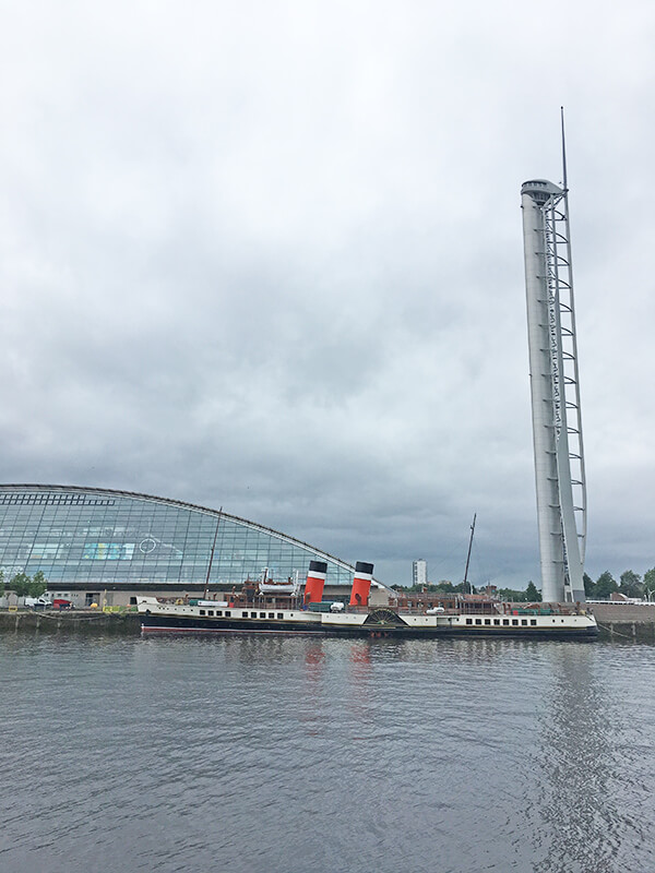
Paddle Steamer Waverley
I arrived at Chatelherault rail station and wondered if I could get the train to Lanark. However, when looking at the destination of the next train and saw that it was only going approximately 2 miles down the line to Larkhall, I decided against it. Besides I didn’t want to cheat, however small the distance was. So, I pressed on in agony, then out of the blue the other knee started hurting.
I don’t quite know how, but I somehow reached New Lanark, making check in. It had been the longest ride of my life at 84 miles. Pedalling entirely for the most part, using my right leg whilst only applying a slight pressure with the left. All of the agony and mental anguish had been completely obliterated, I was absolutely high on endorphins. Yet exhausted, I had done it on only consuming three pastries, a bag of Haribo and a coffee.
I couldn’t believe, in this beautiful, world heritage site, there was a hostel that cost less than £40 for the night and the best part was I had a large room with double bed and walk in shower all to myself, a night of heaven. It didn’t go down well though when during check-in I was horrified to discover the local supermarket was back up the steep hill I had come down, being a 20-minute walk.
Well, I needed supplies, so after I dropped my kit off to the room, I started the walk back up. I bought an obscene amount of food from Morrisons, picking up all manner of things that looked appetising, including deep heat. I even went and picked up a battered sausage and chips from the nearby chippy. Needless to say, I ate like a king that night, nothing went to waste!
Day 08
New Lanark to Gretna – 68.08 mi
Upon waking my mind immediately wondered if my night’s rest and wonderful sleep would have been enough to semi heal the pain experienced in both my knees. Naturally, I put off leaving as long as possible making the most of having a lie in leaving at, bang on, check out time.
From the comfort of my bed, I had a good look at the route I would be following for the day, 68 miles was the distance to cover. It would be a case of continuing to follow the National Cycle Route 74, linking Glasgow to the border. Mostly running alongside the A74(M). I found myself practically side by side with the motorway all the way down. A nice straight forward ride I thought. Plus, I would nearly have completed Scotland arriving close to the border.
Obviously, I didn’t want to make the same mistake after leaving the Trossachs National Park, the previous day, so ensured that I had double helpings of porridge at breakfast.
Once everything was attached, there was no other route out of New Lanark than to ascend the only, steep, road that lead down to the site. There was no way I was cycling up that fully laden, so ended up pushing all the way to the top.
Reaching the main road, running through Lanark, it was a short descent down over the River Clyde, through Kirkfieldbank. Once over the bridge and a swift left turn, I was back onto the familiar quiet undulating country lanes, whilst making my way south to a junction at the M74.
At reaching the M74, passing underneath, I continued my way along the B7078. Although there was a dedicated cycle lane marked by a white line, kind of like a hard shoulder, it was an incredibly fast road with the occasional car or lorry hurtling past. I firmly stayed as close to the verge as possible. The progress was very slow going, despite a large breakfast my legs were weary.
Thankfully, after just over a mile I got off of the main road since there was a dedicated cycle lane running parallel. I could finally relax and enjoy the experience, taking in the views of the surrounding vast open moor land, all without the need to worry about traffic racing past.
It was about halfway along when the dreaded pain in both knees returned to punish me from overuse of the never-ending turns of the crank. In some instances, it became unbearable, my left was still worse than my right so again I found myself pedalling using one leg for the most part. Ever grateful for the downhill sections that I could slowly coast along. I took a short stop I applied copious amounts of deep heat to the area in the hope it would provide some respite, which it did numb the pain slightly, not for very long.
Arriving at Abington provided a big motivational boost, I had got off of the B7078 and was roughly a quarter of the way closer to my destination. My next target was to get past Elvanfoot, located on the opposite side of the River Clyde.
After checking the profile of the terrain for my route, I knew that a few miles past Elvanfoot was literally downhill all the way to, Westlands Country Park, my destination. Although I would still have to pedal it certainly made the remainder of the 40 or so miles glorious and felt a breeze to coast most of the route, despite adding a couple of unnecessary miles after taking a wrong turn at the village of Beattock, I had got mixed up with another cycle route.
After passing through Lockerbie it was onwards through to Ecclefechan and Kirtlebridge where I, shortly after, made a left turn onto the quiet country lanes. Making my leisurely way to the campsite. The weather had even come out for the finale of the leg, the evening was glorious.
When I reached the campsite, I was greeted by the friendliest and most welcoming of staff. A special mention goes to Aaron, who went out of his way to make me feel extremely welcome, letting me watch tv and chatting until I turned in for the night.
Day 09
Gretna to King’s Meaburn – 54.86 mi
I awoke around 5:00am to the patter of rain on my tarp, cursing this wretched weather. I had endured so much rain, I pleaded for just a few days of normal dry weather, was it was too much to ask to have a few dry days. I didn’t want to ride on an empty stomach so boiled some rice for breakfast whilst huddled, pressed up against my bike, trying to keep dry.
Although, by now I had become so unfazed by the bad weather, I just accepted it. I gathered my strength and manged to pull myself from the vice like grip of my sleeping bag and preceded with, a sense of urgency in packing everything away as the rain had become decidedly harsher.
Today’s plan was to reach a small village of Orton, 8 miles from Appleby-in-Westmoreland, or get as close to it as possible at least. I noted that the elevation was the complete opposite of yesterday, it was going to be an ascent, at least all the way to Penrith.
After getting a mile down the road from Leaving Westlands Country Park, I discovered I had left my bungee cords back at the pitch! Without as much as a grumble, I stoically did an about turn and cycled back to recover them. I couldn’t have abandoned them as I had no accommodation booked for the night and would be wild camping. They were essential for tying my tarp up.
With the bungees recovered and secured, I set about on my way again. With the rain lashing down I made my way up into the south of Gretna, making the decision to stop at a convenient store to pick up some supplies, consisting of cakes a can of coffee. The weather was so miserable I just wanted to plod on, so didn’t hang about.
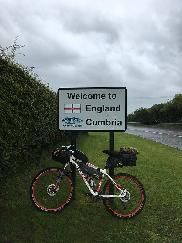
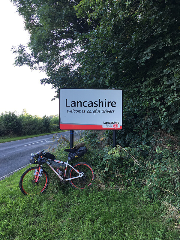
I knew it was nearby, but not long after Gretna, I was pleasantly surprised to arrive at the Scotland/England border. Of course, I had to get the customary photo of my bike propped up against the sign. It was also a moment of reflection; I had just ridden the entire length of Scotland! I was now crossing into England and the homeward stretch.
The route I was following from the book took a very long detour up through Longtown. There was no way I was interested adding unnecessary mileage onto my journey so decided to cut along the sideroad running parallel to the M6, passing over the Channel of River Esk, a much quicker way to reach Carlisle.
I had arrived at a level crossing, rain ferociously lashing down, with two cars waiting for the barriers to lift. What preceded was the longest wait I have ever experienced at a level crossing. I had pulled up close to the barrier, balancing on my bike, I held onto the post to my left. I kept peering left and right keeping my eyes peeled for any sign of trains. After a few minutes a train did come hurting down the track. I thought great that was it, expecting the barriers to soon lift, yet nothing. I sat here for what seemed like an eternity waiting for another train to appear. It was during this period, completely soaked to the bone, rain continuing to pour the hardest it had been, and no warm accommodation booked for the evening, contemplating what on earth I was actually doing with my life.
As soon as the barrier lifted, I let the cars go ahead then went on my way, pushing the thoughts the negative thoughts from my mind. After rounding a corner, I passed a female cyclist, going in the opposite direction, who shouted words to the effect of “We must be mad!”. This did make chuckle and I seemingly perked up, realising I wasn’t the only one out here.
Before I knew it, I was in front of Carlisle Castle and took respite underneath some sheltered steps of the foot bridge, crossing the road. Here, I reminisced on my previous brief encounter with Carlisle, when I attempted to walk Hadrian’s wall path, some years prior, only making it halfway across after picking up an injury.
This time in Carlisle was also to be a brief visit, I didn’t want to waste too much time. My route took me south heading along the River Caldew and over to Dalston. Then, south east through the quiet country lanes to Penrith, by now the rain had thankfully died off, despite it threatening to rain.
Around late afternoon I found myself wondering aimlessly around the center of Penrith. Food was on my mind and thankfully found a Greggs where I set about in buying the lot! Well, not quite everything, but certainly came away with a lot, meat pies, pastry slices, cakes and a coffee. Luckily there was a bench just outside so took a pew and had a mini feast, shared with a couple pigeons, much to the amusement of a nearby child.
With it being so late in the afternoon and no accommodation booked, I was always conscious of the time as I still had quite a distance to cover. I made my way down through the villages of Great Strickland, then over to Morland and soon found myself wondering through King’s Meaburn.
By this point it was lashing down again, the darkness was creeping in and my energy was truly zapped. As I passed by the White Horse Inn, that’s where I spotted it, a stone bus shelter! I went in for a closer inspection, inside was a bench full of books, still enough room to sit down. That’s it I thought, I’m not moving. I decided it would be the perfect place to get my head down for the night.
Not long after, a friendly couple visiting the pub, pulled up in the car park in front of me and came over and chatted for a few minutes. They kindly invited me in for a drink, but regrettably declined, worried about leaving my bike alone. As soon as it was dark, I blew up my roll mat, hung my soaking wet clothing up and crawled into my sleeping bag still damp from the day and fell fast asleep.
No sooner as I had drifted off, I was getting woken by a lady attempting to drop off the morning papers for the villagers on the bench behind me. I immediately sprang up and apologised, apparently it was quite common sight for her to find cyclist sleeping in bus shelters.
Day 10
King’s Meaburn to Forest of Bowland – 60.21 mi
Today’s cycle would be to the Forest of Bowland. Again, I had no accommodation booked but knew roughly that I wanted to at least reach somewhere in the middle, preferably Slaidburn. Due to the lady dropping the papers off, it crossed my mind the villagers would soon be over collecting them. I thought I would make a swift exit before anyone arrived so skipped breakfast. There was a café in Orton so would stop there.
I packed everything away and started to attach my bags, I was horrified to discover my front wheel was completely flat. I thought, how could this have happened? The bike hadn’t moved all night, it was perfectly fine before I fell asleep. I pumped it up, thinking it would be fine and headed down the lane. No sooner as I got a few hundred metres the wheel was flat again.
What should have been a quick change of the innertube turned into over an hour wasted, faffing about. I decided that it would be best to go back to where I originally was. At least there was a bench I could sit down on. I pumped air into the flat wheel and headed back along the lane to the shelter, only for the wheel to soon go flat. This was no good, walked to the entrance of a field and propped by bike up against the gate and I set about changing the tube. Luckily the weather had decided to be kind.
Once I successfully changed the tube It occurred to me that the back might have lost some air, during my journey so far. I thought it a good idea to maybe put a bit of air in. After topping it up, I went to undo the hose connector, the uppermost part of the valve core came away from the main body and all the air came gushing out! I couldn’t believe it. This happened at least twice. Screwing the core back into the body pumping the tyre up and trying to take the pump hose off without it coming away again. In the end I employed the help of pliers to tighten the valve.
I did eventually manage to get on my way, making it to Orton, stopping in Orton Scar Café for a slap-up fry up. A popular stop on the Coast to Coast walk. Leaving Orton, I headed west to towards the M6. I passed under the southbound carriage and found myself in-between the centre, it reminded me much like a no man’s land between northbound and southbound carriages. I preceded up a service road about half a mile before realising I was going the wrong way. I should have crossed under both carriages.
Once I was heading in the correct direction, I made my way through the hamlets of Greenholme, down through Roundthwaite, the route heading along quiet roads close to the M6. Once it was back over the opposite side of the M6 the road ran high above, providing a fantastic vantage point down through the valley. From the village of Beck Foot, I continued west and skirted around the eastern outskirts of Kendal, to Natland.
From Natland I was to then arrive at a very pretty village of Beetham, here I stumbled across a delightful little shop with Tea Room. Sadly, the Tea Room had just closed so I was left with what little the shop offered, only stocking up on the usual sugar laden treats of cakes sweets and cans of pop, thinking it would be enough. Opposite was a church yard, as the sun had come out, I made the most of it and parked up at the bench in the church’s grounds. Sprawled across the bench exhausted, I grabbed a precious few minutes of relaxation.
Leaving Beetham was up a very steep hill climb, I didn’t have the energy so found myself pushing for the most part. A short distance after Slackhead I found myself yet again heading in the wrong direction, another additional mile on top of what I had to cover. After the error, I made my way over to Borwick, Gressingham and Hornby. Passing through Hornby I remarked at what a beautiful place it was. The stone buildings looked very pretty.
I continued to pass thorough Wray and Mill Houses until I arrived at a crossroads and instantly spotted another, stone sheltered, bus stop. I thought of having another night of luxury and making the shelter my home. But, decided against it, Slaidburn was still another 13 miles, any extra distance I could make up now would be less I would have to travel the following day.
A little further up the road from the shelter, I came across a dense patch of woodland, I spent some time looking on the map and saw that this was probably the best I was going to get for the night, it would provide a bit of protection against the elements. By this point I was absolutely devoid of energy. So, I entered the woodland and quickly set about making a shelter, conscious of keeping a low profile.
Day 11
Forest of Bowland to Manchester – 65.75 mi
After a night of tossing and turning, as was always the case when wild camping, I had to get up and get going. There was no laying in putting it off I was straight up, gear packed within minutes. Checking the map, I saw there was a Tearooms in Slaidburn, so skipped breakfast. However, it was still 13 miles away, that was considerable distance on my heavily laden machine.
From stumbling out of the trees onto the road, I felt mentally and physically drained, nothing inside whatsoever. I ate the last few sweets I picked up the day before and drank, in one gulp, a can of fizzy pop, hoping it would be enough to make it to Riverbank Tearooms.
I set off pedalling at a slow state, I was faced with a 6 mile ascent to reach the peak, iwas headed up and over before the decent into Slaidburn. Those 6 miles were quite possibly the hardest I’ve had to endure, and I have done a lot of physically demanding things. As soon as the incline increased more I was walking, pushing my lumbering beast of a bike, head drapped over the bars just enough energy to push. It is times like this when you have to dig deep as it is so very easy to give up.
Fortunately, I was in the middle of nowhere, I had no other choice but to press on. I think if there had been a nearby rail station I may have got on a train. But then again maybe not. I was however adamant at packing it in once I reached Manchester, getting a train back to Devon the next morning.
Once I struggled over highest point, I shot down the steep descent in no time at all. But led straight into another climb, again the same pattern followed, get off and push. In the end, the 13 miles to Slaidburn took me 2 hours. To top it off, just as I got there it started raining.
To my horror the Teamroom’s Wi-Fi was down, so card payments were off. Thankfully I had cash on me for emergencies, and this was an emergency as I needed food! A large fry up followed by coffee and cake went down nicely, as I chatted to a guy local to the area, telling me about his fantastic sounding adventures he had been on.
As I planned my route, I didn’t like the look of heading up and over Easington Fell, to reach Waddington, just north of Clitheroe, where I noted there was a train station. I decided to stick to the National Cycle route taking a slight detour passing near to Bolton by Bowland and Grindleton and on through the large village of Whalley. The fry up, however, had saved me. it was like having a new lease of life, steaming on through to Whalley.
I passed through Whalley crossing over the River Calder and turned left onto Whalley Old Road. Every hill I encountered seemed to be biggest one. Although this probably wasn’t, I was in for another massive climb, this time 3 miles, bringing me close to Dean Clough Reservoir. However, the climb was a breeze, I was fully charged and didn’t stop once to get off and push.
I then made my way down to the Leeds and Liverpool Canal following it into Accrington. I completely lost the National cycle trail signs and spent some time near the train station trying to work out how to get back on the correct path. Turns out I was actually on the path, I needed to head over the railway line past Tescos, continuing down through the Woodnok Vale Nature reserve, following along an old railway line, now path.
I made my way south, skirting around the eastern side of Haslingdon, through into Holcombe Brook. Arriving to the north western corner of Bury at the town centre. I was located near enough to the centre of town, in front of the Peel Memorial. The National Cycle Route signs had once again disappeared so had no idea which way to go. I took a seat on a bench and sought directions.
After a going in the wrong direction a few hundred metres, through the town, I doubled back, deciding to head south and got back on track. My destination of Salford’s Premier Inn now only seemed like it was only around the corner. I was full of energy, the endorphins had certainly kicked in. What an unbelievable change from setting off this morning. I was ready to pack it in coming over the Forest of Bowland and now to have even consider such a thing utterly disgusted me.
It wasn’t long until I passed through the University of Salford and made my way along the final bit of the A6, finally arriving at my hotel for the evening. All the places I had stayed, I was given the warmest of welcomes and the staff at premier Inn were also superb, they made me feel most welcome. I chose a night of luxury here as they allow you to take bikes into their rooms, plus it was a Sunday, so the room was really cheap. It was pure luxury and the food was sublime.
Rather than take my bike to the room I put it the storeroom. By now my clothes were absolutely stinking, I had been switching between socks since the start so decided to set about and do some laundry in the bathroom sink. After a half assed job, I laid everything out to dry and made my way down to the restaurant and ate like a king. Gobbling down a three-course meal it didn’t even touching the sides. Afterwards, it was straight up to my room to make good use of the double bed. Pure luxury!
Day 12
Manchester to Bridgnorth – 88.88 mi
As soon as I woke, I scurried down for breakfast devouring as much as I could. Today was going to be a massive ride so ate large fry-up, bowl of cereals, a load of Danishes, along with multiple cups of coffee to wash it all down.
I collected my bike from the storeroom, rather than get the foyer covered in mud and oil I decided it best to take my bike outside to fit all the panniers and gave my chain a good oiling. Considering the state of it, it was surprisingly holding up very well.
Today, the Sustrans cycle book I was following went completely out the window. I certainly didn’t want to be taking the scenic route by adding a lot of mileage on my already massive ride. I checked the night before and thankfully google maps loaded me a route that followed along the canal path down to Broadheath.
Setting off from the hotel I made my way along the Bridgewater Canal Towpath. Naturally, I had set off during rush hour and became a case of dodging people walking along the tow path on their way to work. Thankfully as I headed further away from Salford there were no more sign of anymore commuters. The canal ran directly behind Old Trafford, literally within spitting distance, I took an obligatory photograph and pressed on all the way to Broadheath, to the south west of Manchester city centre.
Just after Broadheath I joined onto the Trans Pennine Trail, it was just under a 5 km, dead flat, straight line. At arriving at the main road, I had a very nice surprise, someone had knitted a blue sign with JOGLE written in white and attached it to the gate. I couldn’t believe it! Did someone know I was coming, I thought chuckling to myself.
I headed south and made my way over the M6 for the final time, surprised to arrive at Northwich. This was my first phycological marker and it felt like I had reached it in no time at all, with ease! Passing through Northwich the trail followed alongside the beautiful River Weaver, all the way down to Winsford.
From Winsford the route then headed south down to Nantwich along a single country lane. I again, seem to cover the distance in no time. I came in from the north and pulled up to an inviting looking wall, next to the town car park. I was at my third checkpoint and more importantly halfway. Here, I took a 10-minute rest stop whilst loading up on sugar. I was feeling excellent, all my worries about not making it to Bridgnorth had dissipated. Also, the previous day’s thoughts of wanting to pack it in coming over the forest of Bowland absolutely repulsed me, to have even considered packing it in and getting the train home!
My stop in Nantwich was only fleeting. Leaving south west of the town I made my way over to Wrenbury, then south east passing north of Shavington Park, sticking to the country lanes. It was a case of just getting my head down and turning the pedals. Another thing that caught my attention that I hadn’t noticed, my knees no longer hurt. Maybe they had finally got used to the abuse they had been put under, or simply given up.
Market Drayton was the next marker, although I passed far to the north. When I finally arrived at the B5062, as I was blindly following Google Maps route, it decided to take me through the heart of a farm which lead to a dead end. I quickly doubled back leaving whoever’s property it was, with a car following me back down the drive. Thankfully, it was only a slight detour which brought me out to where the farm track was supposed to lead.
A few minutes later I entered in to the north of Telford and quickly found myself leaving. It was all cycle path, forming part of the Silkin Way, following dry canal beds and former railway lines. This lead all the way down to Coalport, joining up with the River Severn.
A few minutes later I entered into the north of Telford and quickly found myself leaving. It was all cycle path, forming part of the Silkin Way, following dry canal beds and former railway lines. This lead all the way down to Coalport, joining up with the River Severn.
I was now getting really close to Bridgnorth, approaching the final 10 km of this epic cycle. I made the mistake of having Google Maps on in front of me still. I couldn’t help but keep glancing at the distance left to cover, a big mistake! I tried to resist the urge to keep looking, at one point I thought I must have covered at least a km, but no, it had only dropped by not more than a couple hundred metres. The closer I got to Bridgnorth, the distance remaining seemed like it was getting further away! At least the track was level.
At the end of the track, I rounded the corner and arrived at North Gate. As soon as I saw the gate, I knew I had made it to Bridgnorth, the sheer joy on my face was yet again euphoric. I had just completed the longest ride of my life, arriving around 5:30 pm with still plenty of time to spare. In total I managed to cover the distance of 88.88 miles with an elapsed time of 9:11 hours. Plus, I had found it incredibly easy. What a difference it makes when you are loaded up with calories.
Day 13
Bridgnorth to Gloucester – 74.46 mi
Each hotel or place I stayed at I always ensured that I managed to fill up on a hearty breakfast. I did once again at The Croft. I must say, you will receive a most welcome stay. After a large, delicious breakfast, I went to clear out my room and bring my gear down into the foyer.
Here, I was greeted by another couple guys cycling the correct way, Land’s End to John O’Groats. It then hit me one of them looked vaguely familiar. You know when you know who someone is but you’re not entirely sure? I had an inkling at the back of my mind who it was but didn’t say anything and continued talking, on how our journeys had been so far and what the proceeding sections would be like.
Later on, I did have to stop and look him up. I did a search on the web; he was who I thought it was! I had been chatting to the childhood legend Timmy Mallet and his mate. I remember the previous evening when picking up supplies, I overheard the lady in the local Tesco’s saying how Timmy Mallet had been in a little earlier. Well, I missed out on getting a photo with Timmy Mallet.
Heading off from the hotel I made my way down to the bank of the River Severn, to the historic bridge that links east and west of the town. After admiring the scenery, I plotted my route on Google maps and headed south out of the town along the B4555. It was only a short distance from leaving the town that I encountered the first hill of the morning, despite being well rested and fully fuelled my legs were as heavy as lead, my speed dropped to a slow crawl. With my legs as they were, I did think if this was the sign of things to come.
After roughly two miles I managed to get off the B4555, back onto the quiet country lanes and made my way to the small hamlet of Hampton Loade, by-passing the heritage railway station, which forms part of the Seven Valley Railway heritage line. The trail continued south, practically running parallel with the railway on my right and River Severn to my left. It was on down to the Severn Valley Country Park where it was a steep climb up to the visitor centre. Thankfully the sun had now come out so I thought this would be a good opportunity for a short rest on one of the benches, overlooking the beautiful valley.
Pressing on, through country lanes, believing the worst of the hills were over, it wasn’t long until I descended into the village of Upper Arley, that sits on the north bank of the River Severn. A foot bridge at the base of the hill links the village to the opposite side along with Arley railway station. The station, built in 1862, serves as a stop on part of the heritage line and has even been featured in many films and tv shows. I did take a quick look at the station from the bridge and remarked at how immaculate it all looked, and to have a breather as the incline out of the valley was again extremely steep. Needless to say, I ended up walking up. As I struggled, a group of cyclists came whizzing up past, wishing me a good morning with words of encouragement.
As soon as the road levelled out I was back in the saddle, heading south to Buttonoak, situated in the Wyre Forest. It was then a case of following along the B4194 all the way in to Bewdley, a very picturesque riverside town. A place that I would have liked to of taken some time to explore, with a stroll along the riverside. But, as I had a lot of miles to cover I pressed on.
Passing over the River Severn again, I continued along the B4195, until finding my way back on to the country paths, leading through Burlish Top Nature Reserve, passing first through Stourport-on-Severn and making my way along quiet country lanes to Droitwhich Spa which fortunately changed into well signposted cycle lanes so managed to make it through fairly quickly
Once through Droitwich Spa the route took me close to the M5, even coming to within 100 metres at one point. Despite still being a long way from home, I did sense a small feeling of joy that came over me. The M5 runs all the way to Exeter, I’ve driven up and down it so many times I’ve always thought of it as being the home straight. It reminded me of the distance that I had covered since the start of my journey.
The journey continued following alongside the M5 then down through the eastern side of Worcester. The route followed along cycle paths that cut through housing estates, until leaving at through the south of Worcester. The trail then led me over the opposite side of the M5. Crossing the bridge, I stood in the middle and peered down the motorway, thinking although extremely dangerous, how easy it would be to ride down the hard shoulder, all the way to Exeter.
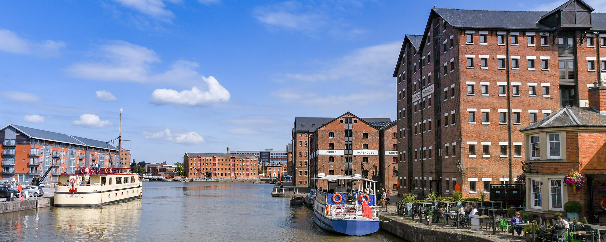
I pressed on along the very quiet county lanes passing back over the opposite of the M5 for the final time and made my way into the north of Tewksbury, onwards through Forthampton, over to Hartpury, then arriving at Gloucester Docks.
I was absolutely ecstatic upon reaching the docks. Although, I couldn’t rest yet as I had to get to the south side of Gloucester, my sister had kindly let me stay with her for the night in, which turned out to be a perfect stop. This would also be my third night sleeping in accommodation. The remaining 5 miles were fortunately completely flat along the canal side which made for a very leisurely ride.
Day 14
Gloucester to The Mendips – 64.79 mi
Tonight, I had planned to stop in the Mendips but didn’t have anywhere booked, the plan was to wild camp. I had a quick search in the morning for any camp sites and managed to find Mendip Camp. Perfect I thought, plus it was only £8 to pitch for the night and was in the perfect location, situated just above Cheddar.
After saying goodbye to my sister, her partner and Rupert (their adorable black pug), I headed off leaving about 08:30. I quickly popped to Tesco’s then made my way through Quedgeley to the Gloucester Canal, following it south. It was quite a nice change to be able to follow a completely flat route when starting out.
I made my way through Frampton on Severn, taking a small deviation from the canal, then on down to Sheperd’s Patch. Here, I left the canal and continued along quiet roads to Berkeley, onwards down through to Olverton. Nothing much exciting happened but it was an absolute joy to cycle along, I remarked the beauty of the area. As it was approaching lunch, I popped into the local bakery I spied and bought some delicious goodies including a quiche, cake and drink. As the weather was beautiful, I went back and relaxed on the church steps for a short time.
Attempting to leave Olveston, I somehow managed to take a wrong turn, ending up down the dead end of a housing estate. A quick about turn and headed out towards the M48 and over the M4. I did consider heading through Bristol city centre. However, I thought of how busy the traffic would be, decided against it.
I continued my way down to Avonmouth, over the M5 bridge, a footpath and cycleway runs alongside. Once over I found myself heading around the perimeter of the car import centre. I had driven up and down the M5 countless times, I did always wonder about the hundreds of cars parked up down there.
It was round to Portbury, then southwest along the quiet road running way down below the M5 to Cleavedon. From Cleavedon, it was then south to Yatton. Here, I joined onto the Strawberry Line, once a disused railway line, now a wonderful path for cyclist and walkers. This led me all the way down to Sandford.
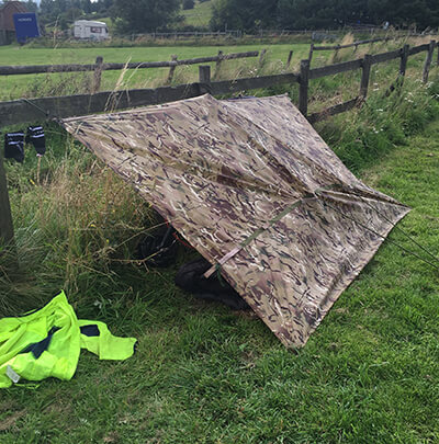
So far, the route had been, for the most part entirely flat, apart from some undulating terrain. What followed was a very steep climb up to the top of the Mendips to reach the camp site. As per usual I had no energy left, the sun was also out so it was hot. I ended up pushing most the way up. It seemed to go on forever and found myself getting angry. When would it bloody end and where was this campsite! Finally arriving, I just flopped down in the field, spread eagled and soaked up the sun, relieved at reaching my destination. There were no facilities apart from a toilet block. I set up my tarp against the fence and basked in the remaining sunlight until I turned in.
Day 15
The Mendips to Exeter – 77.96 mi
I woke up early, as was always the case when wild camping, and managed to pack everything away very quickly, I had managed to finally stop faffing about so much when packing everything away. I settled on my final bag of rice and tuna for breakfast, which was not very appetising. I had cycled 88 miles home from Bristol a few weeks prior as part of a training ride. Now that I was past Bristol and up on the top of the Mendips, I thought it would be an easy run back to Exeter, providing a much-needed boost in motivation.
Leaving the campsite, it was thankfully a long descent all the way into Cheddar, along the Somerset Levels to the very pretty village of Wedmore. Cycling through the village my eyes immediately spotted the sign outside The Swan advertising coffees, so decided to stop off for a morning coffee and summarise the route ahead. The previous time I had rode from Bristol to Exeter we headed over the Black Down Hills, towards Honiton. I settled on a more, flatter route this time, heading over to Bridgewater, along the canal path to Taunton, next, over to Tiverton then down through the Exe Valley.
As expected, leaving Wedmore was a nice, easy flat section across the Somerset Levels passing through Cossington and Bawdrip. Once through Bawdrip, blindly following the sat nav, it wasn’t until a mile after that I realised the road entered out onto the A39. I didn’t particularly fancy riding on a busy A road, going at a slow pace, I about turned and rode back where I was supposed to turn off on to a path that ran alongside the King’s Sedgemoor Drain. It was then on through Chedzoy where I joined up to the River Parrett. Upon reaching Bridgewater it was then, 14.5 miles all the way to Taunton, along the Bridgewater to Taunton Canal, a picturesque route; a great spot for walking.
When I finally made it to Taunton I was going to take a rest stop at French Wear park, but with it being such a hot day in the middle of the week, the place was a hive of activity so thought I would press on and find a shop to pick up supplies. I feel I have to add that French Wear Park is the start of The Two Counties Way, a beautiful long-distance walk; starting in Taunton and finishes in Starcross, in the Exe Estuary.
From French Wier, the National Cycle Route 3 passed through the grounds of Bridgwater & Taunton College, through Bishops Hull where I spotted a shop so ensured I fuelled up on cans of pop a hot sausage roll and 2 pastries and took a break on the bench outside the shop. From here the trail followed close by to the remnants of the canal that used to run from Tiverton to Taunton, passing through Nynehead.
Upon reaching Greenham I joined back on to the Grand Western Canal, the bit that is still in working order. Like the Bridgewater to Taunton canal, this section provides another lovely walk or cycle route as it meanders through the countryside passing the sleepy villages of Sampford Peverell and Halberton.
Reaching Halberton, I departed from the canal tow path and headed along country lanes to Butterleigh, cutting diagonally across, and entering out on to the A396, that runs between Tiverton and Exeter. This was one A road that I certainly didn’t mind going on, I’ve ridden down it so many times I could practically ride it blind folded; I always break the villages on this road into sections so I know exactly how far I have left to go. It was over the bridge at Stoke Canon, rounded the corner then a left turn onto Pennsylvania Road for a 1.2-mile climb, the final hill of the day; not what you need after a 78-mile cycle ride!
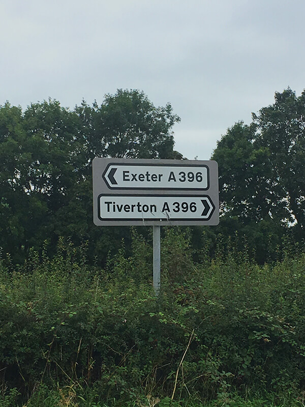
Finally, I had made it back home. It was strange walking through the door, thinking that 16 days ago I had set out on my epic adventure and here I was back home. Like I had just been out on a long cycle. As soon as I walked in the door, I sprang into action to get everything sorted for the next morning.
With only two days left of cycling I discarded anything that I no longer required to try and lighten the load. I plugged everything in that needed to be charged. Put a change of clothes on, grabbed my road bike and headed down the hill to Morrisons.
However, as I had been spending up to 10-11 hours a day on my mountain bike for the past 16 days, with its long bars and more upright riding position, I had lost my ability to ride a road bicycle. I was all over the road trying to find my balance.
After stocking up on lots of food for the evening and a few bits for the remainder of my journey I had to once again ascend the hill back to my flat. This was just not happening, I had been accustomed to the extra gearing on my mountain bike and I had nothing left in my legs after the long day, so walked the final 900 metres back.
Getting back, I loaded up on the calories. As I finally had access to a proper bicycle pump, I discovered to my horror my rear tyre only had a pressure of 20 psi! No wonder it felt like I had been riding through treacle, although they didn’t seem flat. I did wonder if they had been like that since the slow puncture incident on Day 10. After a long hot shower, I assumed the horizontal position and fell into a wonderful sleep.
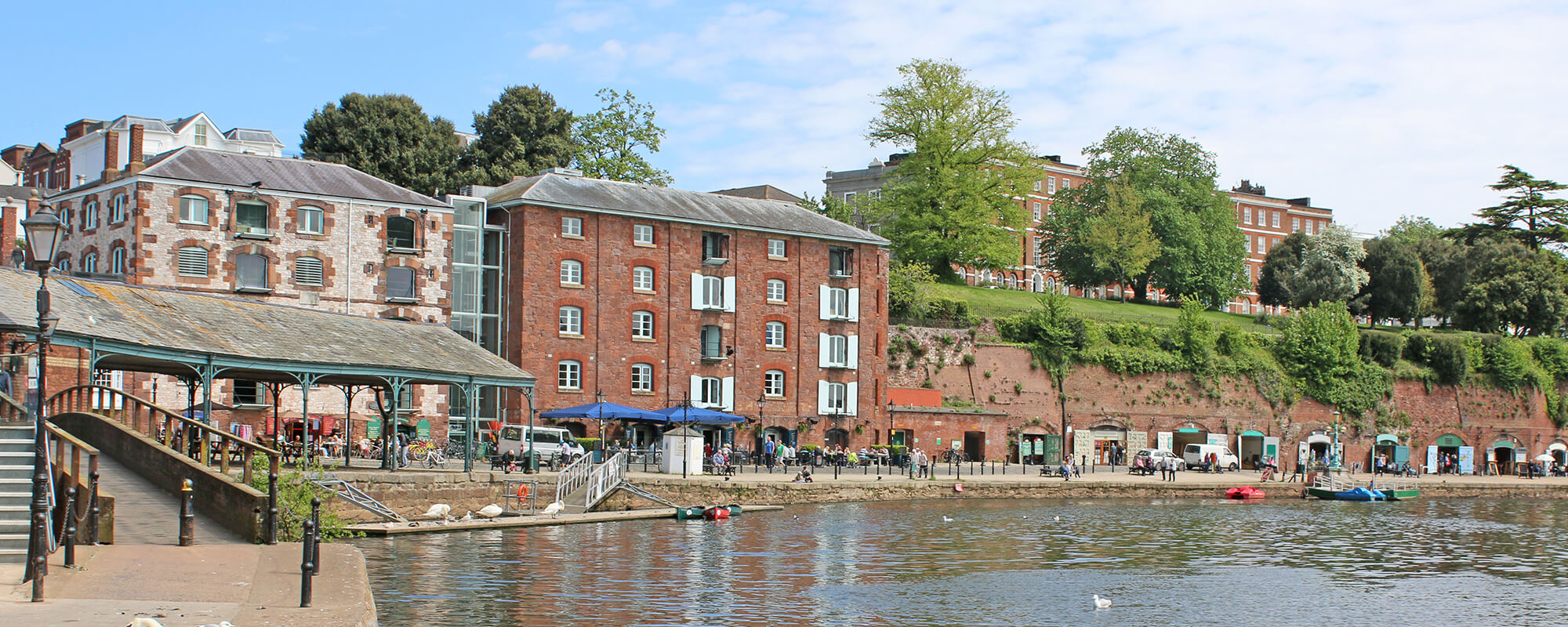
Day 16
Exeter to Dartmoor (Brentor) – 36.48 mi
After having a fantastic night’s sleep, due to the routine of waking up early I woke around 6:00 am. What followed was exactly what I knew would happen, which is why I originally decided against planning to stop at home. But, as I had managed to keep to the schedule, I had at least 3 days to spare before my train home that I had originally booked, plenty of time!
So, I laid in bed for a good few hours, constantly saying to myself, just another 30 minutes. I eventually left my flat around 12:15 pm. I did take this time to fuel up on 3 pots of porridge, 3 cups of coffee and numerous cereal bars.
Leaving my flat, I used the same route I had taken to get to St David’s station when I originally left. It did feel a little strange, only a few days ago when I was heading along this route to set off for the other side of the country. Although this time I was to continue past St David’s, over Exe bridges and head up through the steep part of Exeter, Exwick. This initially involved a 4-mile climb before a decent into Ted Burn St Mary. Basically, following the National Cycle Route 279. Before I set off, I figured this was my best route. I would have had to have conquered hills whatever the route; I might as well take the more direct approach.
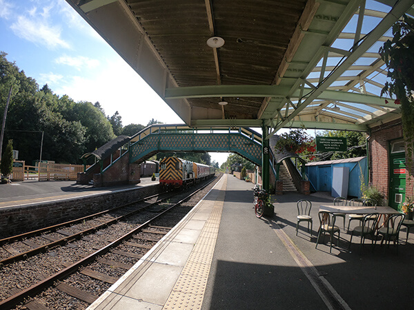
After passing the village of Tedburn it was through into Whidden Down, then along to South Zeal, a combination of many more long hills and descents. The day was absolutely beautiful, the heat blistering, which made getting to Okehampton hard going. However, the views were quite spectacular. Before I knew it, I had arrived in Okehampton. Situated on the northern plateau of Dartmoor, Okehampton is located almost centrally in Devon.
Every time I visit Okehampton I seem to end up visiting the café located at the train station. So of course, I had to factor in a rest stop and grab a bite to eat. Plus, it was also the start of the Granite Trail Cycle Path; running between Okehampton to Lydford Gorge, the route I would be taking before heading over to Launceston.
Whilst taking on much needed calories I did ponder what cycling through Cornwall would be like. I was venturing into uncharted lands, not having really properly explored further west, other than a couple trips to Newquay in the past. I also had no accommodation booked for the evening, so I had to keep an eye out for a suitable location.
The station is also the start point of another long-distance walking route, the Devonshire Heartland Way; running from Okehampton to Stoke Canon, situated just outside to the north of Exeter. More information can be found here.
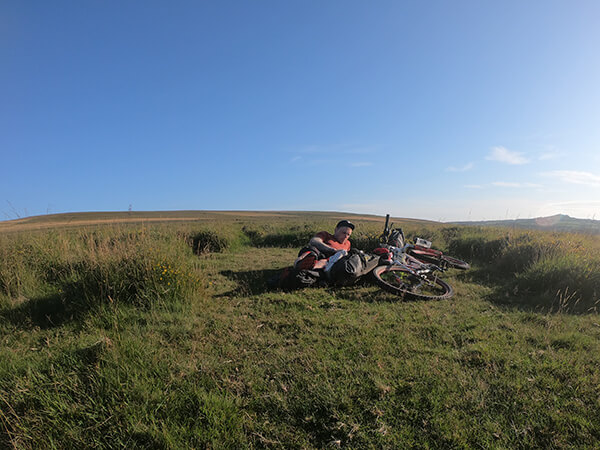
From the station, I was to follow along the Granite trail all the way down to Brentor, stopping at another café that formed part of an old train carriage overlooking the Meldon Aqueduct and reservoir. It was now getting into early evening and decided on getting past Lydford Gorge at least. The area to the south is open moorland, where you can legally wild camp. However, the area was completely devoid of trees to hook my tarp up against, it was also devoid of any phone signal. I did consider pitching up against the stone wall.
In the end, as the weather was glorious, I wondered further up the hill, thinking id be able to at least get some sort of phone coverage the higher I went, but no, I could just get one bar if I rested my phone on the handle bars and not touch it. Well here I was, no cover and exposed. I thought I’d take the risk and sleep under the stars. I rolled out my roll mat and sleeping bag and laid there, joyous to know that I only had a couple days left to push.
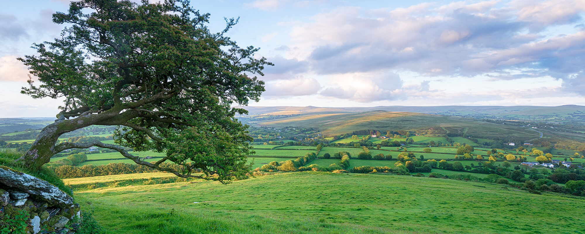
Day 17
Dartmoor (Brentor) to Veryan – 73.63 mi
After a restful night’s sleep under the stars, I awoke early to catch the sunrise, and swiftly fell back to sleep for another couple hours, not getting up until around 9 o’clock. So much for my plan on getting away early!
Even though well rested and a good night’s sleep, I didn’t really have any motivation to carry on. Of course, I was going to finish it though. Leaving the moorland, I made my way through Brentor, over to Chilaton, then through to the village of Lifton. Here I stopped in the local shop to grab some breakfast and pulled up on the village green to relax for a few minutes. Lifton is right on the border so I was very excited to be crossing over into the final county on this adventure. Despite all that I heard about Cornwall being bad for hills.
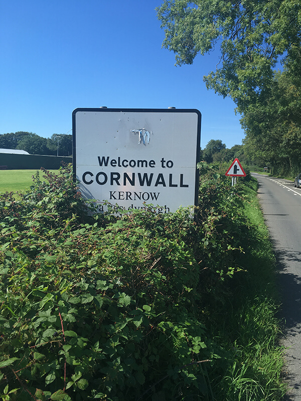
From Lifton, it was not far to Launceston. On my way, I came across the Cornwall border sign. I certainly had to get a mandatory photo to mark the occasion. With cars following behind me I slowed down, indication I was going to stop. As I went to put my foot down, there was no floor, just a ditch running alongside, partly hidden by the foliage. Luckily, I didn’t end fully up in the bushes, but my leg was scratched to pieces, and bleeding, from the brambles. I must have looked a right fool to the car behind.
Once through Launceston, I made my way north west up through Egloskerry, over to Tresmeer then across to Hallworthy. It was just as they said, the hills were terrible! It reminded me a bit like the optical illusion where it appears that stairs are always leading upwards. Because it seemed like I was always heading uphill with hardly any descents.
Soon I found myself passing through the remnants of Bodmin Airfield. Here, I faced a monumental battle with the most ferocious headwind I have encountered. Glad to get as far away from the airfield as possible I continued along windy backroads until joining up with the camel trail which lead all the way into Bodmin.
My original plan was to follow the book, heading in the direction of Newquay, then down to Turo. This was a considerable distance to looked at the alternative of heading through St Austall, getting the ferry crossing at Trelissick Landing, further on. This seemed a much better idea as it was a much shorter distance.
After the switch in my planned route, the race was on to catch the last ferry crossing at 10:30. This was a mammoth task at my current rate, I still had 20 km to cover. On a normal road bike this would have been more than doable. But as always, with the terrain, it was hard going. Whilst heading along a country lane an open gate leading into afield caught my eye. The dark was creeping in and I thought if I left it any later then it would have been more of a hassle setting up camp.
I pulled into the field to have a look. I propped my bike up against the fence and sat on the damp floor, not wanting to set my tarp up, paranoid that a tractor would come bounding through the entrance at any second.
After a few minutes, I though the field opposite might be better. It had some sort of vegetables growing so thought no one would be out here at this time of night. Plus, there was a closed gate across the entrance. As it was now dark, I made my move, I entered the adjacent field and scooted along the hedge line a few metres. The sky was overcast but thought I would risk not getting the tarp out as I didn’t want kit all over the place, just in case I needed to be off on my toes in a hurry. I laid in my sleeping bag surrounded by cabbages, laid in a tyre track with brambles to the right of me.
As I was laying there, the patter of rain started. I quickly leapt into action and hastily erected a bad attempt of a shelter. There was nothing to hook the bungees around, apart from brambles so got quite scratched in the process. As I laid back down, a few minutes later a car arrived at the gate, headlights illuminating the whole area. My god I thought, they’re coming in!
It was actually the entrance to a long drive leading up to a farm. Thankfully nobody saw me. This did leave me pancaking a bit, if they were to leave early in the morning then surely, they would see me. I packed everything up and moved back to the original field and spent the night just in my sleeping bag, my roll mat was now completely flat from multiple puncture from brambles. Thankfully It didn’t rain!
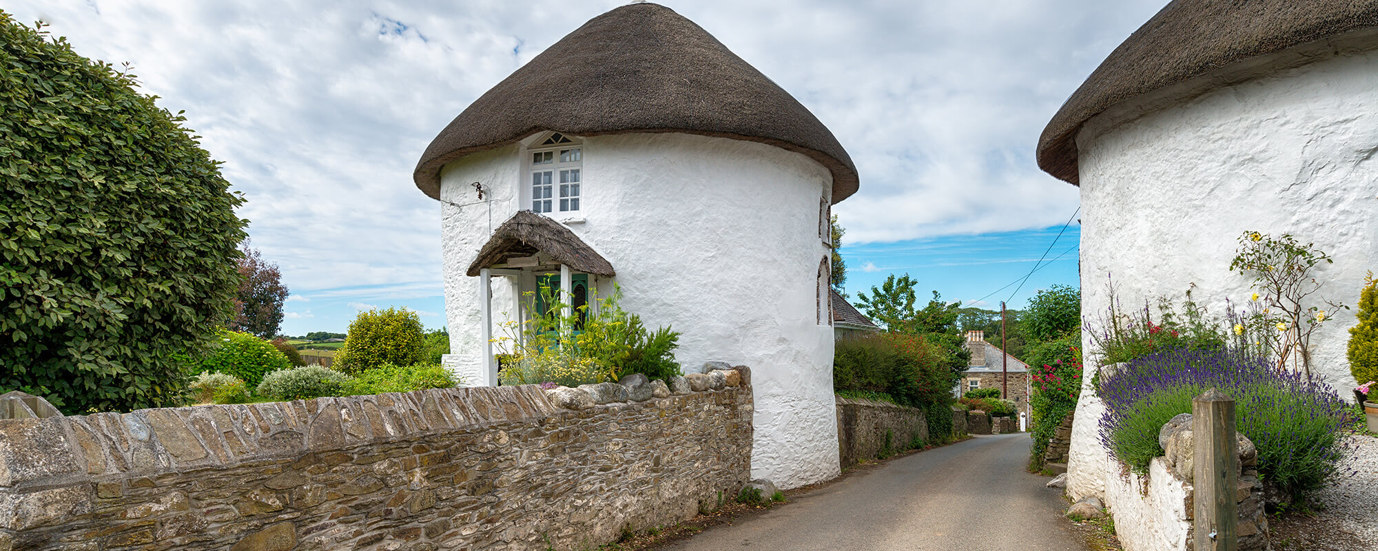
Day 18
Veryan to Land’s End – 53.51 mi
After the night’s comedic performance, I woke early getting about 3 hours sleep. Every time I wild camped there were normally two common features, a terrible night’s sleep and the inability to get out of my snug sleeping bag. This time however, I was up with kit packed away in minutes.
This was partly down to the thought of today being the final day of this monumental journey. I would be in my own bed later on was certainly enough motivation to get me going.
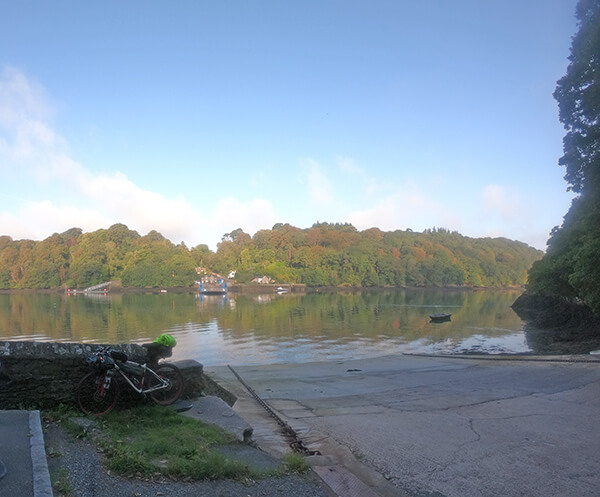
Leaving the field, it was a short distance down in to the, very pretty village, of Veryan, then on through to King Harry Ferry Crossing. When I arrived at the crossing, It was all very quiet I thought. Upon checking the large sign, I discovered I got the timings of the first ferry wrong. It was of course a Sunday, the ferries started running an hour later. I propped my bike up against the wall, took a seat on the curb and had breakfast, a bag of Haribo.
Closer to the time the ferry was due to run, I was joined by another cyclist, a guy who had recently relocated to the area from South Africa. We had a friendly chat and once reached the other side he sped off on his way. Whilst I slowly made my way through Carnon Downs, over to Four Lanes where I popped into the local shop and bought more food. I don’t really remember much of this section, I was just concentrating on digging in and moving forward.
I had given up on following the book now, I was just following Google Map’s recommendation, still following quiet roads. I passed on through Praze-an-Beeble, Leedstown then over to St Erth. From st Earth I headed southwest down to Marazion, thinking it was Penzance. I stopped by the wall and I felt a little emotional. Although I still had a way to the finish line, I felt I was so close.
I pressed on not wanting to hang about too long and made my way around to Penzance. I thought I might give it a go at following the book again. The route took me around to Mousehole, over to St Buryan. The going was extremely hard with very steep hills. As soon as I would get to the top It would be downhill straight into the next incline. I spent a lot of time walking up the hills, as I had very little motivation left in me. It seemed the closer I got to the finish line the harder it was to find the motivation.
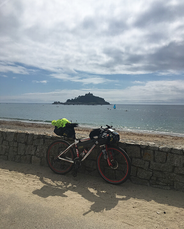
However, after passing through St Buryan, I was ever so close. I had passed through Trevescan, now on the home straight. As soon as I saw Land’s End’s car park the biggest smile covered my face!
I raced to the ticket booths, a guy waved me straight through and told me to go proceed directly ahead, the road that leads down to the iconic building and final couple hundred metres. It was a slow pedal all the way down, as I was thinking about the journey I had just completed, I had made it!
A grass bank opposite from the entrance of the main building looked very appealing, I sat down with a huge smile still on my face, trying to comprehend what I had just accomplished. The whole complex was absolutely heaving with people, although that is probably not surprising, it being a sunny Sunday in the middle of the school holidays.
After a few minutes rest I wanted to have a look around the area and of course find the sign, to get my picture taken. This was a very special moment and I certainly won’t be doing again so thought it would be a nice memento to hang up on the wall. After standing line for about 25 minutes it was my turn I opted for ‘Matt’s JOGLE, 8th-25th August’. Afterwards, a number of people came up to me and asked questions, one guy even wanting my picture taking with him.
It was then round to the hotel, inside the foyer is a logbook that you can sign and is full of people who have completed or are setting off on LEOG/JOGLE. I proceeded to the café for a bite to eat, opting for a chicken burger and chips, which was rather disgusting. Why I didn’t choose a pasty, being in Cornwall, I do not know. I also had a celebratory pint of Cornish cider.
But, the time had come to turn around and cycle the 12 miles back to the station in Penzance to catch the 7:00pm train; I chose a route that was a lot shorter and flatter than following the National Cycle Trail out from Penzance, arriving at the station with an hour to spare.
In all I found arriving at the finish line had been all rather anticlimactic, apart from a huge smile, I didn’t really have any feelings of elation. I was pleased that I had made it, later learning I had covered over 1100 miles, I was just thankful that it was over.
Over the next couple days, I did experience a small sense of sadness. I missed the routine of getting up and setting off to a different place, it felt kind of weird not being on a bike as I had spent so long, between 10-12 hours, in the saddle each day. But, looking back what an amazing experience, to have ridden the length of the United Kingdom the hardest way possible.
The best thing about completing it was getting to experiencing the changing landscapes of the country, how each county has its own unique features and beautiful villages. Not forgetting everyone who stopped by for a chat and those who helped me out, it really made my experience a lot more special.
If you’ve been thinking about completing LEJOG/JOGLE, I highly recommend giving it a go!
Distance: 1123.05 miles
Moving Time: 119:35:27
Elevation: 17,627 m